
Ringen topographic map
Interactive map
Click on the map to display elevation.
About this map
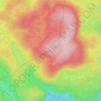
Name: Ringen topographic map, elevation, terrain.
Location: Ringen, Vegårshei, Agder, Noorwegen (58.84215 8.78261 58.84225 8.78271)
Average elevation: 386 m
Minimum elevation: 234 m
Maximum elevation: 485 m
Other topographic maps
Click on a map to view its topography, its elevation and its terrain.
Ugelen
Noorwegen > Agder > Kristiansand
Ugelen, Kristiansand, Agder, 4625, Noorwegen
Average elevation: 4 m