
Marnardal topographic map
Interactive map
Click on the map to display elevation.
About this map
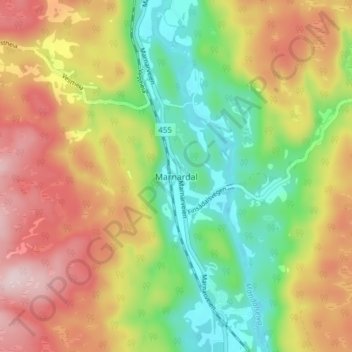
Name: Marnardal topographic map, elevation, terrain.
Location: Marnardal, Lindesnes, Agder, 4534, Noorwegen (58.19330 7.49359 58.23330 7.53359)
Average elevation: 162 m
Minimum elevation: 20 m
Maximum elevation: 327 m
Other topographic maps
Click on a map to view its topography, its elevation and its terrain.
Ugelen
Noorwegen > Agder > Kristiansand
Ugelen, Kristiansand, Agder, 4625, Noorwegen
Average elevation: 4 m