
Åmli topographic map
Interactive map
Click on the map to display elevation.
About this map
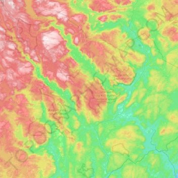
Name: Åmli topographic map, elevation, terrain.
Location: Åmli, Agder, Noorwegen (58.61434 7.96138 58.98502 8.75971)
Average elevation: 416 m
Minimum elevation: 99 m
Maximum elevation: 920 m
Other topographic maps
Click on a map to view its topography, its elevation and its terrain.
Ugelen
Noorwegen > Agder > Kristiansand
Ugelen, Kristiansand, Agder, 4625, Noorwegen
Average elevation: 4 m