
Øyuvsvatnet topographic map
Interactive map
Click on the map to display elevation.
About this map
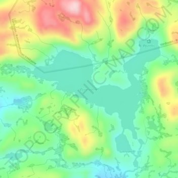
Name: Øyuvsvatnet topographic map, elevation, terrain.
Location: Øyuvsvatnet, Valle, Agder, Noorwegen (59.00942 7.20072 59.02471 7.24017)
Average elevation: 983 m
Minimum elevation: 896 m
Maximum elevation: 1,134 m
Other topographic maps
Click on a map to view its topography, its elevation and its terrain.
Ugelen
Noorwegen > Agder > Kristiansand
Ugelen, Kristiansand, Agder, 4625, Noorwegen
Average elevation: 4 m