
Ljosland topographic map
Interactive map
Click on the map to display elevation.
About this map
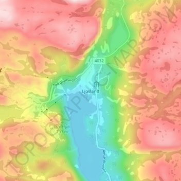
Name: Ljosland topographic map, elevation, terrain.
Location: Ljosland, Åseral, Agder, Noorwegen (58.76774 7.33314 58.80774 7.37314)
Average elevation: 730 m
Minimum elevation: 497 m
Maximum elevation: 936 m