
Lillesand topographic map
Interactive map
Click on the map to display elevation.
About this map
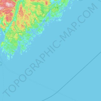
Name: Lillesand topographic map, elevation, terrain.
Location: Lillesand, Agder, Noorwegen (57.91723 8.14452 58.33330 8.75382)
Average elevation: 18 m
Minimum elevation: -1 m
Maximum elevation: 322 m
Other topographic maps
Click on a map to view its topography, its elevation and its terrain.
Ugelen
Noorwegen > Agder > Kristiansand
Ugelen, Kristiansand, Agder, 4625, Noorwegen
Average elevation: 4 m