
Rysstad topographic map
Interactive map
Click on the map to display elevation.
About this map
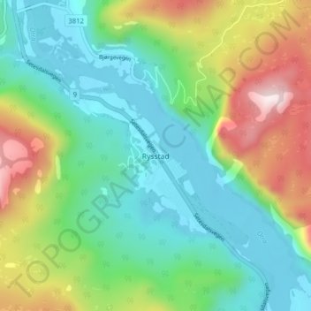
Name: Rysstad topographic map, elevation, terrain.
Location: Rysstad, Valle, Agder, Noorwegen (59.06947 7.52162 59.10947 7.56162)
Average elevation: 447 m
Minimum elevation: 239 m
Maximum elevation: 906 m
Other topographic maps
Click on a map to view its topography, its elevation and its terrain.
Ugelen
Noorwegen > Agder > Kristiansand
Ugelen, Kristiansand, Agder, 4625, Noorwegen
Average elevation: 4 m