
Kvinesdal topographic map
Interactive map
Click on the map to display elevation.
About this map
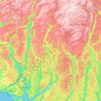
Name: Kvinesdal topographic map, elevation, terrain.
Location: Kvinesdal, Agder, Noorwegen (58.21332 6.71301 58.82271 7.18385)
Average elevation: 457 m
Minimum elevation: -1 m
Maximum elevation: 1,036 m
Other topographic maps
Click on a map to view its topography, its elevation and its terrain.
Ugelen
Noorwegen > Agder > Kristiansand
Ugelen, Kristiansand, Agder, 4625, Noorwegen
Average elevation: 4 m