
Byremo topographic map
Interactive map
Click on the map to display elevation.
About this map
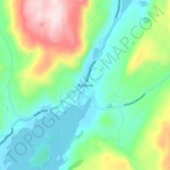
Name: Byremo topographic map, elevation, terrain.
Location: Byremo, Lyngdal, Agder, 4529, Noorwegen (58.40149 7.38258 58.44149 7.42258)
Average elevation: 236 m
Minimum elevation: 109 m
Maximum elevation: 525 m
Other topographic maps
Click on a map to view its topography, its elevation and its terrain.
Ugelen
Noorwegen > Agder > Kristiansand
Ugelen, Kristiansand, Agder, 4625, Noorwegen
Average elevation: 4 m