
Iveland topographic map
Interactive map
Click on the map to display elevation.
About this map
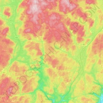
Name: Iveland topographic map, elevation, terrain.
Location: Iveland, Agder, Noorwegen (58.30860 7.78226 58.55740 8.10988)
Average elevation: 282 m
Minimum elevation: 21 m
Maximum elevation: 556 m
Other topographic maps
Click on a map to view its topography, its elevation and its terrain.
Ugelen
Noorwegen > Agder > Kristiansand
Ugelen, Kristiansand, Agder, 4625, Noorwegen
Average elevation: 4 m