
France topographic map
Interactive map
Click on the map to display elevation.
About this map
Name: France topographic map, elevation, terrain.
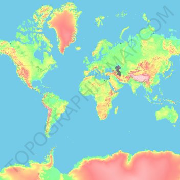
Location: France (-50.21872 -178.38737 51.30557 172.30572)
Average elevation: 430 m
Minimum elevation: -30 m
Maximum elevation: 6,542 m
Metropolitan France has a wide variety of topographical sets and natural landscapes. Large parts of the current territory of France were raised during several tectonic episodes like the Hercynian uplift in the Paleozoic Era, during which the Armorican Massif, the Massif Central, the Morvan, the Vosges and Ardennes ranges and the island of Corsica were formed. These massifs delineate several sedimentary basins such as the Aquitaine basin in the southwest and the Paris basin in the north, the latter including several areas of particularly fertile ground such as the silt beds of Beauce and Brie. Various routes of natural passage, such as the Rhône Valley, allow easy communication. The Alpine, Pyrenean and Jura mountains are much younger and have less eroded forms. At 4,810.45 metres (15,782 ft) above sea level, Mont Blanc, located in the Alps on the French and Italian border, is the highest point in Western Europe. Although 60% of municipalities are classified as having seismic risks, these risks remain moderate.
Other topographic maps
Click on a map to view its topography, its elevation and its terrain.
Philippines
Philippines
Average elevation: 33 m
Malolos
Malolos, Bulacan, Central Luzon, 3000, Philippines
Average elevation: 6 m
Suffolk County
Suffolk County, New York, United States
Average elevation: 34 m
Mandaluyong
Mandaluyong, Eastern Manila District, Metro Manila, 1551, Philippines
Average elevation: 33 m
Sorsogon City
Sorsogon City, Sorsogon, Bicol Region, 4700, Philippines
Average elevation: 89 m
Zamboanga City
Philippines > Zamboanga Peninsula > Zamboanga City
Zamboanga City, Zamboanga Peninsula, 7000, Philippines
Average elevation: 83 m
Cebu City
Philippines > Cebu > Cebu City
Cebu City, Cebu, Central Visayas, 6000, Philippines
Average elevation: 140 m
Pasig River
Pasig River, Namayan, District I, Mandaluyong, Eastern Manila District, Metro Manila, 1009, Philippines
Average elevation: 8 m
Boise
United States of America > Idaho > Boise
Boise, Ada County, Idaho, 83702, United States of America
Average elevation: 1,040 m
San Pablo
Philippines > Laguna > San Pablo
San Pablo, Laguna, Calabarzon, 4000, Philippines
Average elevation: 220 m
Quezon City
Quezon City, Eastern Manila District, Metro Manila, Philippines
Average elevation: 57 m
Santa Ana
United States > California > Orange County
Santa Ana, Orange County, California, United States
Average elevation: 30 m
Calama
Chile > Antofagasta Region > Provincia de El Loa
Calama, Provincia de El Loa, Antofagasta Region, 1395584, Chile
Average elevation: 2,653 m
Balindong
Balindong, Lanao del Sur, Bangsamoro, 9318, Philippines
Average elevation: 822 m
Lanas
Philippines > Romblon > San Jose
Lanas, San Jose, Romblon, Mimaropa, 5510, Philippines
Average elevation: 35 m
Batangas City
Batangas City, Batangas, Calabarzon, 4200, Philippines
Average elevation: 65 m
Samal Island
Philippines > Davao del Norte > Samal
Samal Island, Samal, Island Garden City of Samal, Davao del Norte, Davao Region, 8119, Philippines
Average elevation: 117 m
Bowen Island Municipality
Canada > British Columbia > Metro Vancouver Regional District
Bowen Island Municipality, Metro Vancouver Regional District, British Columbia, Canada
Average elevation: 95 m
Carling Township
Canada > Ontario > Parry Sound District
Carling Township, Parry Sound District, Central Ontario, Ontario, P0G 1G0, Canada
Average elevation: 180 m
Shebeshekong Lake
Canada > Ontario > Parry Sound District > Carling Township
Shebeshekong Lake, Carling Township, Parry Sound District, Central Ontario, Ontario, Canada
Average elevation: 205 m
The Archipelago Township
Canada > Ontario > Parry Sound District
The Archipelago Township, Parry Sound District, Central Ontario, Ontario, Canada
Average elevation: 204 m
Tacloban
Philippines > Leyte > Tacloban
Tacloban, Leyte, Eastern Visayas, 6500, Philippines
Average elevation: 29 m
Dasmarinas
Philippines > Cavite > Dasmarinas > Buhi
Dasmarinas, Cavite, Calabarzon, 4114, Philippines
Average elevation: 114 m
Rizal
Philippines > Quirino > Rizal
Rizal, Quirino, Cagayan Valley, Philippines
Average elevation: 130 m
Davao City
Philippines > Davao Occidental > Davao City
Davao City, Davao Region, Philippines
Average elevation: 303 m
Scenic Viewpoint
Vietnam > Ninh Bình Province > Hoa Lư District > Tam Cốc
Scenic Viewpoint, Thai Vi, Tam Cốc, Hoa Lư District, Ninh Bình Province, 08213, Vietnam
Average elevation: 27 m
Donnelly
United States > Idaho > Valley County
Donnelly, Valley County, Idaho, United States
Average elevation: 1,483 m
Maligaya
Philippines > Agusan del Sur > Rosario
Maligaya, Rosario, Agusan del Sur, Caraga, Philippines
Average elevation: 78 m
Baguio
Baguio, Cordillera Administrative Region, 2600, Philippines
Average elevation: 1,371 m
Laguna de Bay
Laguna de Bay, Southern Manila District, Laguna, Calabarzon, Philippines
Average elevation: 62 m
Taal Volcano
Philippines > Batangas > San Nicolas
Taal Volcano, San Nicolas, Batangas, Calabarzon, 4207, Philippines
Average elevation: 91 m