
Manila topographic map
Click on the map to display elevation.
Manila
Almost all of Manila sits on top of centuries of prehistoric alluvial deposits built by the waters of the Pasig River and on some land reclaimed from Manila Bay. Manila's land has been altered substantially by human intervention, with considerable land reclamation along the waterfronts since the American colonial times. Some of the city's natural variations in topography have been evened out. As of 2013, Manila had a total area of 42.88 square kilometers.
About this map
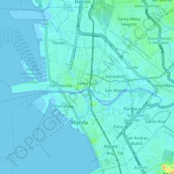
Name: Manila topographic map, elevation, terrain.
Location: Manila, Metro Manila, Philippines (14.55418 120.94169 14.63900 121.02617)
Average elevation: 6 m
Minimum elevation: -1 m
Maximum elevation: 68 m
Other topographic maps
Click on a map to view its topography, its elevation and its terrain.
Plaza de Roma
In 1901, with the start of American rule, the plaza was renamed Plaza McKinley, after U.S. President William McKinley, who authorized the colonization of the Philippines by the United States. The plaza was given its current name in 1961, following the elevation of Rufino Santos to the College of Cardinals of…
Average elevation: 7 m