
Dagali topographic map
Interactive map
Click on the map to display elevation.
About this map
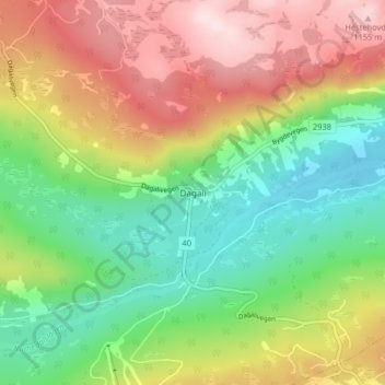
Name: Dagali topographic map, elevation, terrain.
Location: Dagali, Hol, Viken, Noorwegen (60.39145 8.42088 60.43145 8.46088)
Average elevation: 954 m
Minimum elevation: 797 m
Maximum elevation: 1,165 m
Other topographic maps
Click on a map to view its topography, its elevation and its terrain.