
Hallingskarvet nasjonalpark topographic map
Interactive map
Click on the map to display elevation.
About this map
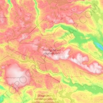
Name: Hallingskarvet nasjonalpark topographic map, elevation, terrain.
Location: Hallingskarvet nasjonalpark, Viken, Noorwegen (60.53522 7.34782 60.72323 8.10755)
Average elevation: 1,345 m
Minimum elevation: 732 m
Maximum elevation: 1,926 m
Other topographic maps
Click on a map to view its topography, its elevation and its terrain.