
Aurskog-Høland topographic map
Interactive map
Click on the map to display elevation.
About this map
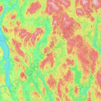
Name: Aurskog-Høland topographic map, elevation, terrain.
Location: Aurskog-Høland, Viken, Noorwegen (59.59365 11.27408 60.02363 11.94600)
Average elevation: 214 m
Minimum elevation: 97 m
Maximum elevation: 400 m
Other topographic maps
Click on a map to view its topography, its elevation and its terrain.