
Sandvika topographic map
Interactive map
Click on the map to display elevation.
About this map
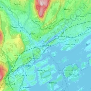
Name: Sandvika topographic map, elevation, terrain.
Location: Sandvika, Bærum, Viken, 1337, Noorwegen (59.85212 10.48499 59.93212 10.56499)
Average elevation: 60 m
Minimum elevation: -1 m
Maximum elevation: 365 m