
Vikene topographic map
Interactive map
Click on the map to display elevation.
About this map
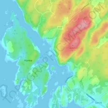
Name: Vikene topographic map, elevation, terrain.
Location: Vikene, Fredrikstad, Viken, Noorwegen (59.19407 10.77292 59.23407 10.81292)
Average elevation: 33 m
Minimum elevation: -6 m
Maximum elevation: 118 m