
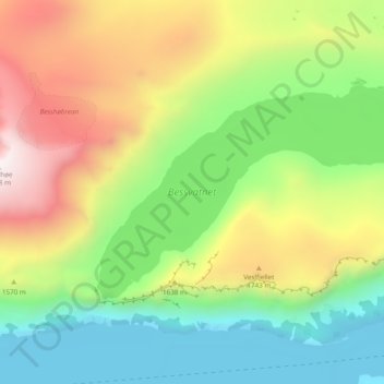
Bessvatnet topographic map
Interactive map
Click on the map to display elevation.
About this map
Name: Bessvatnet topographic map, elevation, terrain.
Location: Bessvatnet, Vågå, Innlandet, Noorwegen (61.50205 8.71197 61.52777 8.80872)
Average elevation: 1,483 m
Minimum elevation: 986 m
Maximum elevation: 2,252 m
Other topographic maps
Click on a map to view its topography, its elevation and its terrain.
Feforvatnet
Feforvatnet, Nord-Fron, Innlandet, Noorwegen
Average elevation: 890 m
Balbergkampen
Balbergkampen, Lillehammer, Innlandet, 2624, Noorwegen
Average elevation: 447 m
Skeikampen
Skeikampen, Gausdal, Innlandet, 2652, Noorwegen
Average elevation: 918 m