
Nord-Aurdal topographic map
Interactive map
Click on the map to display elevation.
About this map
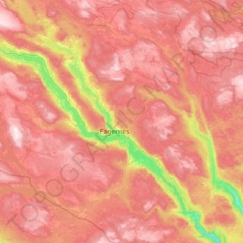
Name: Nord-Aurdal topographic map, elevation, terrain.
Location: Nord-Aurdal, Innlandet, Noorwegen (60.76736 8.88945 61.24070 9.69026)
Average elevation: 844 m
Minimum elevation: 204 m
Maximum elevation: 1,361 m
Other topographic maps
Click on a map to view its topography, its elevation and its terrain.
Feforvatnet
Feforvatnet, Nord-Fron, Innlandet, Noorwegen
Average elevation: 890 m
Balbergkampen
Balbergkampen, Lillehammer, Innlandet, 2624, Noorwegen
Average elevation: 447 m
Skeikampen
Skeikampen, Gausdal, Innlandet, 2652, Noorwegen
Average elevation: 918 m