
Bitihorn topographic map
Interactive map
Click on the map to display elevation.
About this map
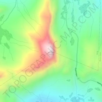
Name: Bitihorn topographic map, elevation, terrain.
Location: Bitihorn, Øystre Slidre, Innlandet, Noorwegen (61.29431 8.79938 61.29441 8.79948)
Average elevation: 1,214 m
Minimum elevation: 998 m
Maximum elevation: 1,606 m
Other topographic maps
Click on a map to view its topography, its elevation and its terrain.
Feforvatnet
Feforvatnet, Nord-Fron, Innlandet, Noorwegen
Average elevation: 890 m
Balbergkampen
Balbergkampen, Lillehammer, Innlandet, 2624, Noorwegen
Average elevation: 447 m
Skeikampen
Skeikampen, Gausdal, Innlandet, 2652, Noorwegen
Average elevation: 918 m