
Gjende topographic map
Interactive map
Click on the map to display elevation.
About this map
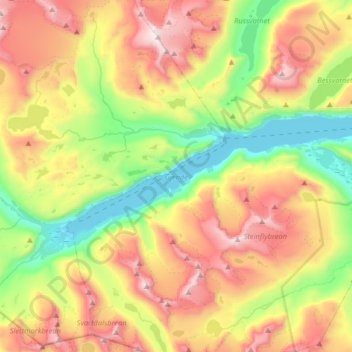
Name: Gjende topographic map, elevation, terrain.
Location: Gjende, Vågå, Innlandet, Noorwegen (61.44601 8.48410 61.49954 8.80836)
Average elevation: 1,574 m
Minimum elevation: 984 m
Maximum elevation: 2,365 m
Other topographic maps
Click on a map to view its topography, its elevation and its terrain.
Feforvatnet
Feforvatnet, Nord-Fron, Innlandet, Noorwegen
Average elevation: 890 m
Balbergkampen
Balbergkampen, Lillehammer, Innlandet, 2624, Noorwegen
Average elevation: 447 m
Skeikampen
Skeikampen, Gausdal, Innlandet, 2652, Noorwegen
Average elevation: 918 m