
Skavdalen topographic map
Interactive map
Click on the map to display elevation.
About this map
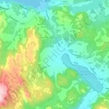
Name: Skavdalen topographic map, elevation, terrain.
Location: Skavdalen, Ørland, Trøndelag, 7160, Noorwegen (63.72505 9.79427 63.76505 9.83427)
Average elevation: 74 m
Minimum elevation: 0 m
Maximum elevation: 257 m
Other topographic maps
Click on a map to view its topography, its elevation and its terrain.