
Fossli topographic map
Interactive map
Click on the map to display elevation.
About this map
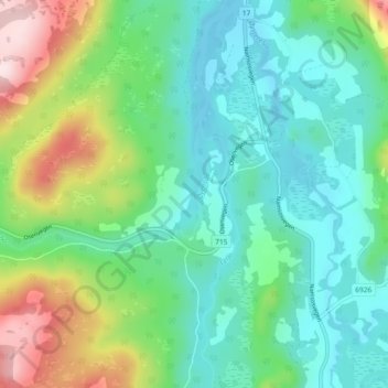
Name: Fossli topographic map, elevation, terrain.
Location: Fossli, Namsos, Trøndelag, 7750, Noorwegen (64.23587 11.16100 64.27587 11.20100)
Average elevation: 101 m
Minimum elevation: -1 m
Maximum elevation: 366 m