
Vøringsfossen topographic map
Interactive map
Click on the map to display elevation.
About this map
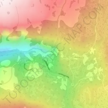
Name: Vøringsfossen topographic map, elevation, terrain.
Location: Vøringsfossen, Eidfjord, Vestland, Noorwegen (60.42686 7.25100 60.42696 7.25110)
Average elevation: 772 m
Minimum elevation: 394 m
Maximum elevation: 1,082 m
Het is een van de hoogste watervallen in Europa. Het water maakt een loodrechte, vrije val van 145 meter op een totale hoogte van 182 meter.
Other topographic maps
Click on a map to view its topography, its elevation and its terrain.
Tunsbergdalsvatnet
Tunsbergdalsvatnet, Luster, Vestland, Noorwegen
Average elevation: 806 m
Norheimsund
Noorwegen > Vestland > Norheimsund
Norheimsund, Kvam herad, Vestland, Noorwegen
Average elevation: 199 m