
Bolstadøyri topographic map
Interactive map
Click on the map to display elevation.
About this map
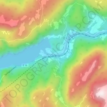
Name: Bolstadøyri topographic map, elevation, terrain.
Location: Bolstadøyri, Voss, Vestland, 5723, Noorwegen (60.61887 5.93818 60.65887 5.97818)
Average elevation: 304 m
Minimum elevation: 0 m
Maximum elevation: 762 m
Other topographic maps
Click on a map to view its topography, its elevation and its terrain.
Tunsbergdalsvatnet
Tunsbergdalsvatnet, Luster, Vestland, Noorwegen
Average elevation: 806 m
Vøringsfossen
Vøringsfossen, Eidfjord, Vestland, Noorwegen
Average elevation: 772 m
Norheimsund
Noorwegen > Vestland > Norheimsund
Norheimsund, Kvam herad, Vestland, Noorwegen
Average elevation: 199 m