
Hardangervidda topographic map
Interactive map
Click on the map to display elevation.
About this map
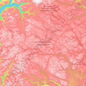
Name: Hardangervidda topographic map, elevation, terrain.
Location: Hardangervidda, Nore og Uvdal, Buskerud, Noruega (59.85620 6.68391 60.40904 8.29844)
Average elevation: 1,183 m
Minimum elevation: 0 m
Maximum elevation: 1,860 m
Other topographic maps
Click on a map to view its topography, its elevation and its terrain.
Ellas have
Ellas have, Hestehaven, Nedre Vigeland, Vigeland, Lindesnes, Agder, Noruega
Average elevation: 79 m