
Finnmark topographic map
Interactive map
Click on the map to display elevation.
About this map
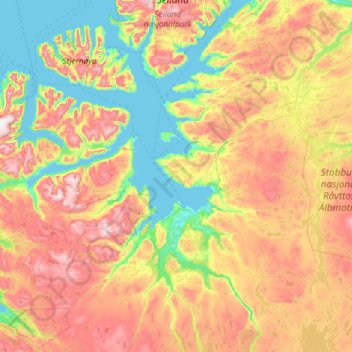
Name: Finnmark topographic map, elevation, terrain.
Location: Alta, Finnmark, Noruega (69.64545 22.18582 70.44802 24.21823)
Average elevation: 363 m
Minimum elevation: -5 m
Maximum elevation: 1,201 m
Other topographic maps
Click on a map to view its topography, its elevation and its terrain.
Ellas have
Ellas have, Hestehaven, Nedre Vigeland, Vigeland, Lindesnes, Agder, Noruega
Average elevation: 79 m