
Trøndelag topographic map
Interactive map
Click on the map to display elevation.
About this map
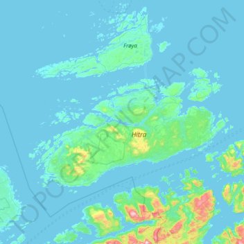
Name: Trøndelag topographic map, elevation, terrain.
Location: Hitra, Trøndelag, Noruega (63.35941 8.10865 63.77365 9.29870)
Average elevation: 39 m
Minimum elevation: -2 m
Maximum elevation: 766 m
Other topographic maps
Click on a map to view its topography, its elevation and its terrain.
Ellas have
Ellas have, Hestehaven, Nedre Vigeland, Vigeland, Lindesnes, Agder, Noruega
Average elevation: 79 m