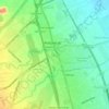
Guagua topographic map
Click on the map to display elevation.
Guagua
The climate and topographical features of the vast land of Guagua make it ideal for the growing of fruit trees and vegetables. Among the fruit trees most fitting to be planted are mangoes, guavas, santol, star apples, and bananas. For vegetables, sitao, upo, ampalaya, gabi and cucumber are the most commonly produced by farmers and which thrive best in the community.
About this map
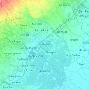
Name: Guagua topographic map, elevation, terrain.
Location: Guagua, Pampanga, Central Luzon, 2003, Philippines (14.92967 120.52108 15.02414 120.66264)
Average elevation: 9 m
Minimum elevation: -2 m
Maximum elevation: 54 m
Other topographic maps
Click on a map to view its topography, its elevation and its terrain.



Angeles
Sapangbato is the largest barangay in Angeles in terms of territory, with a total land area of 104,694 sq. meters and a population of 11,262. Located northwest of Angeles near Clark Freeport Zone, it is identified as the barangay in Angeles with the highest elevation of 750 feet above sea level. It is home to…
Average elevation: 128 m
















Mount Arayat
Philippines > Pampanga > Arayat
Mount Arayat stands in the middle of the flat Central Luzon Plain, consisting of rice paddies and a typical elevation of about 15 to 35 metres MSL. The mountain is topped by a circular volcanic crater about 1.2 kilometres (0.75 mi) in diameter, much of which has collapsed on the western and part of the…
Average elevation: 639 m