
Provincia de Huanta topographic map
Interactive map
Click on the map to display elevation.
About this map
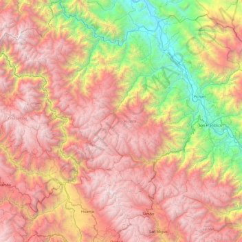
Name: Provincia de Huanta topographic map, elevation, terrain.
Location: Provincia de Huanta, Ayacucho, Perú (-13.06772 -74.58118 -12.16747 -73.82992)
Average elevation: 2,698 m
Minimum elevation: 445 m
Maximum elevation: 4,896 m
Other topographic maps
Click on a map to view its topography, its elevation and its terrain.
Coronel Castañeda
Coronel Castañeda, Parinacochas, Ayacucho, Perú
Average elevation: 4,426 m
Las Tapias
Perú > Ayacucho > Las Tapias
Las Tapias, Parinacochas, Ayacucho, Perú
Average elevation: 3,373 m