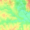
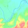
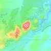
Hopkins County topographic map
Click on the map to display elevation.
About this map

Name: Hopkins County topographic map, elevation, terrain.
Location: Hopkins County, Texas, United States (32.96037 -95.86382 33.37684 -95.30801)
Average elevation: 144 m
Minimum elevation: 99 m
Maximum elevation: 198 m
Other topographic maps
Click on a map to view its topography, its elevation and its terrain.
Georgetown
United States > Texas > Georgetown
The city is located on the northeastern edge of Texas Hill Country. Portions of Georgetown are located on either side of the Balcones Escarpment, a fault line in which the areas roughly east of IH-35 are flat and characterized by having black, fertile soils of the Blackland Prairie, and the west side of the…
Average elevation: 219 m

Flint
United States > Texas > Smith County
Flint is an unincorporated community in southeastern Smith County, Texas, United States. It lies along FM 2493, south of the city of Tyler, the county seat of Smith County. Its elevation is 522 feet (159 m). Although Flint is unincorporated, it has a post office, with the ZIP code of 75762.
Average elevation: 146 m




Sierra Blanca
United States > Texas > Hudspeth County
Sierra Blanca is found in Far West Texas, a subdivision of West Texas, and is 4,520 feet (1,380 m) above sea level. The town is part of the Trans-Pecos region within the most mountainous and arid portion of Texas. The town is located in Hudspeth County, which is large and sparsely populated. Sierra Blanca…
Average elevation: 1,391 m






















Enchanted Rock
United States > Texas > Llano County
Enchanted Rock is a pink granite mountain located in the Llano Uplift about 17 miles (27 km) north of Fredericksburg, Texas and 24 miles (39 km) south of Llano, Texas, United States. Enchanted Rock State Natural Area, which includes Enchanted Rock and surrounding land, spans the border between Gillespie and…
Average elevation: 453 m


Padre Island National Seashore
United States > Texas > Kenedy County > Corpus Christi
Average elevation: 5 m