
Thank you for supporting this site ❤️
Make a donation
Make a donation
Lakehills topographic map
Click on the map to display elevation.
Thank you for supporting this site ❤️
Make a donation
Make a donation
About this map
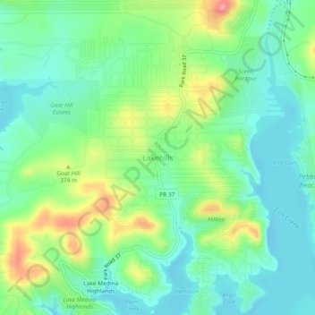
Name: Lakehills topographic map, elevation, terrain.
Location: Lakehills, Bandera County, Texas, 78056, United States (29.56440 -98.96892 29.60440 -98.92892)
Average elevation: 349 m
Minimum elevation: 316 m
Maximum elevation: 418 m
Thank you for supporting this site ❤️
Make a donation
Make a donation
Other topographic maps
Click on a map to view its topography, its elevation and its terrain.