Texas topographic maps
Click on a map to view its topography, its elevation and its terrain.


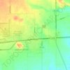

Buffalo Bayou
United States > Texas > Harris County
The Buffalo Bayou watershed is central to the drainage of Houston and Harris County. Lying over relatively impervious soils and very flat topography, the bayou has extensive natural floodplains, as do most Gulf coastal rivers and streams. Urbanization of the watershed has placed thousands of people in…
Average elevation: 24 m


Muleshoe
United States > Texas > Bailey County
Muleshoe is situated on the Great Plains in an area where the plains reach their highest altitude at the foot of the Rocky Mountains known as the High Plains; more specifically, it is located on the South Plains in a region known as the Llano Estacado. The area topology is gently rolling plains with a large…
Average elevation: 1,157 m




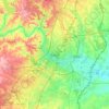
Austin
United States > Texas > Travis County > Austin
The elevation of Austin varies from 425 feet (130 m) to approximately 1,000 feet (305 m) above sea level. Due to the fact it straddles the Balcones Fault, much of the eastern part of the city is flat, with heavy clay and loam soils, whereas the western part and western suburbs consist of rolling hills on the…
Average elevation: 203 m
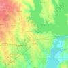
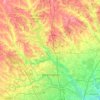








Choke Canyon State Park - Calliham Unit
United States > Texas > McMullen County > Calliham
Average elevation: 67 m


Bannister Wildlife Management Area
United States > Texas > San Augustine County
Average elevation: 76 m





Flint
United States > Texas > Smith County
Flint is an unincorporated community in southeastern Smith County, Texas, United States. It lies along FM 2493, south of the city of Tyler, the county seat of Smith County. Its elevation is 522 feet (159 m). Although Flint is unincorporated, it has a post office, with the ZIP code of 75762.
Average elevation: 146 m









Rio Vista Addition Colonia
United States > Texas > El Paso County > Socorro
Average elevation: 1,116 m






Knott
United States > Texas > Howard County
Knott is an unincorporated community in northwestern Howard County, Texas, United States. It lies along FM 846 northwest of the city of Big Spring, the county seat of Howard County. Its elevation is 2,612 feet (796 m). Although Knott is unincorporated, it has a post office, with the ZIP code of 79748.
Average elevation: 794 m