
Kandi topographic map
Interactive map
Click on the map to display elevation.
About this map
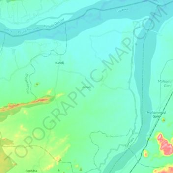
Name: Kandi topographic map, elevation, terrain.
Location: Kandi, Garhwa, Jharkhand, Inde (24.37321 83.68681 24.53755 83.86801)
Average elevation: 162 m
Minimum elevation: 124 m
Maximum elevation: 386 m
Other topographic maps
Click on a map to view its topography, its elevation and its terrain.
Rāmnagartola
Rāmnagartola, Pakaur, Pakur District, Jharkhand, 816107, Inde
Average elevation: 34 m
Sahibganj (block)
Sahibganj (block), Sahibganj District, Jharkhand, 816109, Inde
Average elevation: 60 m