
Ranchi topographic map
Interactive map
Click on the map to display elevation.
About this map
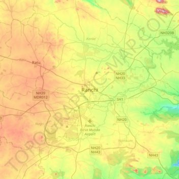
Name: Ranchi topographic map, elevation, terrain.
Location: Ranchi, Kanke, Ranchi, Jharkhand, 834001, Inde (23.21005 85.16504 23.53005 85.48504)
Average elevation: 648 m
Minimum elevation: 458 m
Maximum elevation: 896 m
Ranchi est située à une altitude d'environ 650 mètres, sur la partie sud de la région du Chota Nâgpur qui forme la bordure orientale du plateau du Deccan.