
La Independencia topographic map
Interactive map
Click on the map to display elevation.
About this map
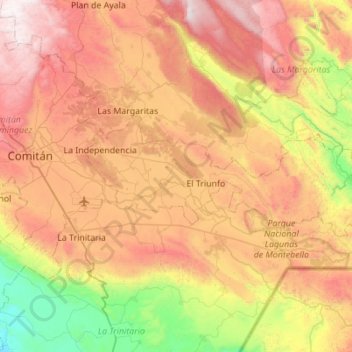
Name: La Independencia topographic map, elevation, terrain.
Location: La Independencia, Chiapas, Mexiko (16.12169 -92.05118 16.30566 -91.49998)
Average elevation: 1,458 m
Minimum elevation: 565 m
Maximum elevation: 2,476 m
Other topographic maps
Click on a map to view its topography, its elevation and its terrain.
Lacanjá Chansayab
Lacanjá Chansayab, Ocosingo, Chiapas, 29550, Mexiko
Average elevation: 335 m
San Juan Chamula
San Juan Chamula, Chamula, Chiapas, Mexiko
Average elevation: 2,297 m
San Cristóbal de las Casas
San Cristóbal de las Casas, Chiapas, Mexiko
Average elevation: 1,796 m