Geolocate

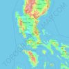
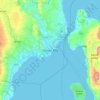
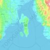
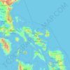
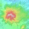
Marinduque topographic map

Click on the map to display elevation.

Marinduque

The highest peak in Marinduque is Mount Malindig (formerly called Mt. Marlanga), a potentially active stratovolcano with an elevation of 1,157 metres (3,796 ft) above sea level, located at the southern tip of the island.

Wikipedia (CC-BY-SA 3.0)

About this map

Name: Marinduque topographic map, elevation, terrain.

Location: Marinduque, Mimaropa, Philippines (13.08007 121.66624 13.70564 122.29290)

Average elevation: 38 m

Minimum elevation: 0 m

Maximum elevation: 1,133 m

Other topographic maps

Click on a map to view its topography, its elevation and its terrain.
Quezon City

Philippines

Founded as a pueblo by Saint Pedro Bautista in 1590, San Francisco del Monte may be considered Quezon City's oldest district. The original land area of the old town of San Francisco del Monte was approximately2.5 square kilometres (1.0 sq mi) and covered parts of what is currently known as Project 7 and 8 and…

Average elevation: 57 m

Samar

Philippines

Average elevation: 38 m

Rizal

Philippines

Average elevation: 95 m

Silang

Philippines > Cavite > Silang

Average elevation: 305 m

Silay

Philippines > Negros Occidental

Average elevation: 44 m

Malolos

Philippines > Bulacan

Malolos is relatively flat of about 0.81% to a gently sloping of 2.17%. The slope of the land descends towards west, southwest to southern direction. The highest land elevation is at about 6.0 meters above sea level while the lowest is only half a meter below sea level. A network of natural waterways and…

Average elevation: 6 m
Cebu City

Philippines > Cebu > Cebu City

Average elevation: 140 m

Roxas

Philippines > Isabela

The landscape of Roxas is relatively compose of flatlands with minimal rise at certain point with base mountain elevations on the eastern part, on the parts of Sinamar, Simimbaan and San Placido. It is approximately 90% of the land area comprising the town can be described as low-lying hills with rolling…

Average elevation: 59 m
Madilay-dilay

Philippines > Rizal > Tanay

Average elevation: 344 m

Lingayen

Philippines > Pangasinan

Average elevation: 4 m

Toledo

Philippines > Cebu

Average elevation: 107 m

Lapu-Lapu

Philippines

Average elevation: 93 m

Davao City

Philippines

Average elevation: 65 m

Batanes

Philippines

Average elevation: 26 m

Meycauayan

Philippines > Bulacan

Average elevation: 27 m

Cabanatuan

Philippines > Nueva Ecija

Average elevation: 47 m

Tarlac City

Philippines > Tarlac

Average elevation: 56 m

San Fernando

Philippines > Pampanga

Average elevation: 24 m

Marikina

Philippines

Average elevation: 80 m

Nabaoy

Philippines > Aklan > Malay

Average elevation: 88 m

Abuan River

Philippines > Isabela

Average elevation: 655 m

Ampucao

Philippines > Benguet > Itogon

Average elevation: 1,317 m

Tarlac

Philippines

Average elevation: 109 m

Nueva Vizcaya

Philippines

Average elevation: 107 m

Bohol

Philippines

Average elevation: 116 m

Luna

Philippines > La Union

Average elevation: 8 m

Angat Dam

Philippines > Bulacan

Average elevation: 254 m

Samal Island

Philippines > Davao del Norte > Samal

Average elevation: 117 m

Panglao Island

Philippines > Bohol

Average elevation: 47 m

Bacnotan

Philippines > La Union

The topography of the town is characterized by hilly and mountainous terrain rising gradually eastward. The western side of Bacnotan is defined by a long stretch of black sand beaches facing the South China Sea, indicative of the area's abundant magnetite deposits. Certain parts of the coastline also feature…

Average elevation: 21 m
Mandaue

Philippines

It is one of the two (the other one being the municipality of Consolacion) local government units located within the mainland Metro Cebu where the elevation of land is less than 100 m (330 ft).

Average elevation: 109 m
Cabuyao

Philippines > Laguna

Average elevation: 93 m

Dauin

Philippines > Negros Oriental

Average elevation: 56 m

Norzagaray

Philippines > Bulacan

Average elevation: 66 m

Butuan

Philippines

Average elevation: 115 m

Bantay

Philippines > Ilocos Sur

It has an average elevation of 100 meters (328.08 feet), with a land area of 7,660 hectares (18,900 acres). It is an elevated and hilly municipality but some barangays, especially those near creeks, are prone to flooding during heavy typhoons.

Average elevation: 8 m

San Gregorio

Philippines > Nueva Ecija > Rizal

Average elevation: 96 m

Cuyapon

Philippines > Cotabato > Kabacan

Average elevation: 12 m

Kasibu

Philippines > Nueva Vizcaya

Average elevation: 868 m

Santor

Philippines > Batangas > Tanauan

Average elevation: 148 m

Badian

Philippines > Cebu

Average elevation: 113 m

Surigao del Sur

Philippines

Average elevation: 274 m

Ibabang Bukal

Philippines

Average elevation: 254 m

Talomo River

Philippines

Average elevation: 201 m

Buenavista

Philippines

Average elevation: 112 m

Teodora Alonzo

Philippines

Average elevation: 1,459 m

Ronda

Philippines > Cebu

Average elevation: 36 m

Bakakeng Central

Philippines

Average elevation: 1,412 m

Pacdal

Philippines

Average elevation: 1,448 m

Cebu

Philippines

Average elevation: 89 m

Camarines Sur

Philippines

Average elevation: 56 m

San Isidro

Philippines > Bohol

Average elevation: 219 m

Dueñas

Philippines > Iloilo

Average elevation: 50 m

Santiago

Philippines > Isabela

Average elevation: 146 m

Naguilian

Philippines > Isabela

Average elevation: 49 m

Aborlan

Philippines > Palawan

Average elevation: 13 m

San Ildefonso

Philippines > Ilocos Sur

Average elevation: 9 m

Las Piñas

Philippines

Average elevation: 14 m

Guiguinto

Philippines > Bulacan

Average elevation: 5 m

Mount Makiling

Philippines > Laguna > Los Baños

Average elevation: 327 m

Ditawini

Philippines > Aurora

Average elevation: 80 m

Laur

Philippines > Nueva Ecija

Average elevation: 91 m

Tacurong

Philippines > Sultan Kudarat

Average elevation: 52 m

Santa Maria

Philippines > Bulacan

The topography of Santa Maria is generally flat, however, it is becoming hilly towards the north. This area covers the barangays of Silangan, Mag-asawang Sapa, Pulong Buhangin and some parts of Balasing with landscape ranging from 8 to 18 percent slope. The rest of the barangays have a slope range from level…

Average elevation: 18 m
Calapan

Philippines > Oriental Mindoro

The overall land characteristic is a wide plain with rivers, interspersed with wetlands at the seacoast periphery. The highest elevation is 187 m (614 ft) above sea level at Bulusan Hill, a 6-kilometre (3.7 mi) long landform east of the city, which interrupts the mostly flat terrain north-east of the…

Average elevation: 40 m
Bayombong

Philippines > Nueva Vizcaya

Average elevation: 318 m

Cabagan

Philippines > Isabela

Average elevation: 29 m

Bacolod

Philippines

Bacólod (English: Bacolod), is derived from bakólod (Old Spelling: bacólod), the Old Hiligaynon (Old Ilonggo) (Old Spelling: Ylongo and Ilongo) word for a "hill, turtle, mound, rise, hillock, down, any small eminence or elevation", since the resettlement was founded on a stony, hilly area, now the barangay…

Average elevation: 49 m
Baguio

Philippines

In 1903, Filipinos, Japanese and Chinese workers were hired to build Kennon Road, the first road directly connecting Baguio with the lowlands of La Union and Pangasinan. Before this, the only road to Benguet was Naguilian Road, and it was largely a horse trail at higher elevations. Camp John Hay was…

Average elevation: 881 m

Burgos

Philippines > Ilocos Norte

Another tourist attraction worth mentioning is the historic Cape Bojeador Lighthouse, built during the latter part of the 19th century. Facing the South China Sea, it serves as a beacon to passing ships and to local fishermen. Because of its high elevation, it offers travelers with a panoramic view of the…

Average elevation: 85 m

Kulisap

Philippines > Zamboanga Sibugay > Payao

Average elevation: 57 m

Patag Island

Philippines

Average elevation: 0 m

Kota Island

Philippines

Average elevation: 0 m

Lankiam Cay

Philippines

Average elevation: 0 m

Central

Philippines > Tarlac > Tarlac City

Average elevation: 43 m

Iriga

Philippines

Average elevation: 115 m

Davao Gulf

Philippines

Average elevation: 0 m

Sadanga

Philippines > Mountain Province

Average elevation: 1,177 m

Mount Halcon

Philippines > Oriental Mindoro

Mount Halcon (Filipino: Bundok Halcon) and (Spanish: Monte Halcón) is the highest mountain in Mindoro. According to the new data released by Oriental Mindoro peakvisor as of 2022, it has an elevation of 2,616 metres (8,583 ft) above sea level, higher than the previous estimates of 2,586 m (8,484 ft) although…

Average elevation: 2,121 m

Lawak Island

Philippines

Average elevation: 0 m

Sinacaban

Philippines > Misamis Occidental

Average elevation: 47 m

Can-avid

Philippines > Eastern Samar

Average elevation: 10 m

Tiwi

Philippines > Albay

Average elevation: 44 m

Bucari

Philippines > Iloilo

Average elevation: 567 m

Santo Domingo

Philippines > Camarines Norte > Vinzons

Average elevation: 15 m

Candaba

Philippines

Average elevation: 6 m

Kinatihan II

Philippines

Average elevation: 22 m

Kinabjangan

Philippines > Agusan del Norte > Nasipit

Average elevation: 17 m

Cabatang

Philippines

Average elevation: 335 m

Pinget

Philippines

Average elevation: 1,430 m

Caloocan

Philippines

Average elevation: 81 m

Aurora Hill North Central

Philippines

Average elevation: 1,479 m

Matina River

Philippines > Davao City

Average elevation: 7 m

Besigan

Philippines

Average elevation: 584 m

Cabugao

Philippines > Ilocos Sur

Average elevation: 25 m

Asin

Philippines

Average elevation: 1,321 m

Catambungan

Philippines

Average elevation: 5 m

Tablas Strait

Philippines

Average elevation: 0 m

Tungkalan

Philippines > Davao City

Average elevation: 478 m

Poliwes

Philippines

Average elevation: 1,397 m