
Taguem River topographic map
Click on the map to display elevation.
About this map
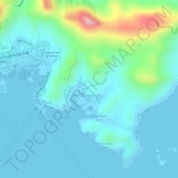
Name: Taguem River topographic map, elevation, terrain.
Location: Taguem River, Coron, Palawan, Mimaropa, 5316, Philippines (11.99365 120.21785 11.99501 120.22053)
Average elevation: 45 m
Minimum elevation: -2 m
Maximum elevation: 237 m
Other topographic maps
Click on a map to view its topography, its elevation and its terrain.
Busuanga
Elevation The municipality's western and central portions are predominantly rough and mountainous with rolling to hilly terrain. A part of this is the Chinabayan Mountain and Wayan Range that still support extensive parches of Molave forest and Cogon grassland (features which are dominant in the locale).…
Average elevation: 16 m
Cagayancillo
There are neither mountain ranges nor forested areas in the municipality. A hilly portion in the north-eastern part of the main island has a slope of 3-82%. The other areas are flat with the highest elevation around 2 to 3 meters. The majority of the island has a sandy loam soil not enough to support a forest.
Average elevation: 0 m
Cuyo
Cuyo Island is the largest island of the Cuyo Archipelago, about 13 kilometers (8.1 mi) long, 7.5 kilometers (4.7 mi) wide, and with an area of 57 square kilometers (22 sq mi). Mount Bonbon with an elevation of 817 feet (249 m) is the highest mountain in Cuyo island. The Island is under the jurisdiction of the…
Average elevation: 0 m