
Kyūshū topographic map
Interactive map
Click on the map to display elevation.
About this map
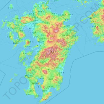
Name: Kyūshū topographic map, elevation, terrain.
Location: Kyūshū, Japon (30.99427 129.55263 33.96988 132.08533)
Average elevation: 116 m
Minimum elevation: -4 m
Maximum elevation: 1,741 m
Other topographic maps
Click on a map to view its topography, its elevation and its terrain.