
South East District topographic map
Interactive map
Click on the map to display elevation.
About this map
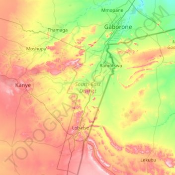
Name: South East District topographic map, elevation, terrain.
Location: South East District, Botsuana (-25.46789 25.53901 -24.51263 26.18860)
Average elevation: 1,162 m
Minimum elevation: 948 m
Maximum elevation: 1,530 m
Other topographic maps
Click on a map to view its topography, its elevation and its terrain.
Selebi Phikwe
Botsuana > Zentral-Distrikt > Selebi Phikwe
Selebi Phikwe, Zentral-Distrikt, Botsuana
Average elevation: 863 m
Ghanzi
Botsuana > Ghanzi District > Ghanzi
Ghanzi, Ghanzi District, Botsuana
Average elevation: 1,143 m
Mopipi
Botsuana > Zentral-Distrikt > Mopipi
Mopipi, Zentral-Distrikt, Botsuana
Average elevation: 908 m
Chobe National Park
Chobe National Park, Nogatsaa - Savuti, Chobe District, Botsuana
Average elevation: 964 m