
Mfuwe topographic map
Interactive map
Click on the map to display elevation.
About this map
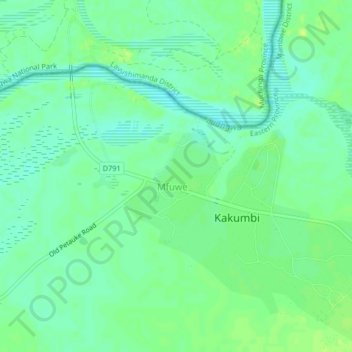
Name: Mfuwe topographic map, elevation, terrain.
Location: Mfuwe, Mambwe District, Eastern Province, Zambia (-13.13068 31.77782 -13.09068 31.81782)
Average elevation: 526 m
Minimum elevation: 519 m
Maximum elevation: 534 m
Other topographic maps
Click on a map to view its topography, its elevation and its terrain.
Vubwi District
Vubwi District, Eastern Province, Zambia
Average elevation: 1,050 m
Chipata
Chipata, Chipata District, Eastern Province, Zambia
Average elevation: 1,133 m