
Vubwi District topographic map
Interactive map
Click on the map to display elevation.
About this map
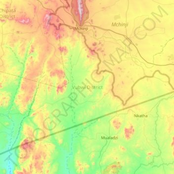
Name: Vubwi District topographic map, elevation, terrain.
Location: Vubwi District, Eastern Province, Zambia (-14.20544 32.64144 -13.78457 33.24108)
Average elevation: 1,050 m
Minimum elevation: 675 m
Maximum elevation: 1,745 m
Other topographic maps
Click on a map to view its topography, its elevation and its terrain.