
Hooghly topographic map
Click on the map to display elevation.
About this map
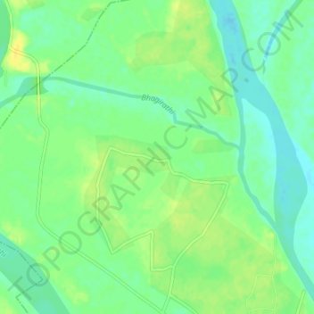
Name: Hooghly topographic map, elevation, terrain.
Location: Hooghly, Murshidabad, West Bengal, 742213, India (24.49483 88.05061 24.51335 88.09110)
Average elevation: 22 m
Minimum elevation: 12 m
Maximum elevation: 33 m
Other topographic maps
Click on a map to view its topography, its elevation and its terrain.
Kolkata
Spread roughly north–south along the east bank of the Hooghly River, Kolkata sits within the lower Ganges Delta of eastern India approximately 75 km (47 mi) west of the international border with Bangladesh; the city's elevation is 1.5–9 m (5–30 ft). Much of the city was originally a wetland that was…
Average elevation: 5 m
Purba Medinipur District
Purba Medinipur district is part of the lower Indo-Gangetic Plain and Eastern coastal plains. Topographically, the district can be divided into two parts – (a) almost entirely flat plains on the west, east and north, (b) the coastal plains on the south. The vast expanse of land is formed of alluvium and is…
Average elevation: 6 m
Bardhaman
India > West Bengal > Burdwan - I > Bardhaman
The region has an average elevation of 40 metres (131 ft). The city is situated 1100 km from New Delhi and a little less than 100 km north-west of Kolkata on the Grand Trunk Road (National Highway 19) and Eastern Railway. The chief rivers are the Damodar and the Banka.
Average elevation: 30 m
Mirik
India > West Bengal > Mirik Subdivision > Mirik
Mirik has an average elevation of 1,495 m (4,905 ft). The highest point is the Boker Monastery at about 1,768 m (5,801 ft). Mirik lake at about 1,494 m (4,902 ft) is the lowest point. Mirik is 52 km (32 mi) northwest of Siliguri city and 49 km (30 mi) south-southwest of Darjeeling town. Mirik subdivision. The…
Average elevation: 1,156 m
Purba Bardhaman
Different types of soil are encountered in topographical biological, hydrological, and geological conditions in the Burdwan district. In the west, coarse gritty soil blended with rock fragments is formed from the weathering of pegmatite, quartz veins and conglomeratic sandstones, where as sandy soil…
Average elevation: 30 m
Baruipur
The Baruipur CD block is located at 22°21′56″N 88°25′57″E / 22.3654432°N 88.4325028°E / 22.3654432; 88.4325028. It has an average elevation of 9 metres (30 ft).
Average elevation: 4 m
Uttar Dinajpur District
The regional topography is generally flat with a gentle southerly slope towards which the main rivers like Kulik, Nagar, Mahananda. The District forms a part of the basin lying between Rajmahal hills on the east. The older alluvium is estimated to be Pleistocene age. Uttar Dinajpur is bestowed with a very…
Average elevation: 45 m
Thakurpukur Maheshtala
Thakurpukur Maheshtala CD block is located at 22°30′31″N 88°15′12″E / 22.5086210°N 88.2532182°E / 22.5086210; 88.2532182. It has an average elevation of 9 metres (30 ft).
Average elevation: 5 m
Kolkata
India > West Bengal > Kolkata
Spread roughly north–south along the east bank of the Hooghly River, Kolkata sits within the lower Ganges Delta of eastern India approximately 75 km (47 mi) west of the international border with Bangladesh; the city's elevation is 1.5–9 m (5–30 ft). Much of the city was originally a wetland that was…
Average elevation: 5 m
Kurseong
India > West Bengal > Kurseong Subdivision
Located at an altitude of 1,482.55 metres (4,864.0 ft), Kurseong is 32 kilometres (20 mi) from Darjeeling and has a pleasant climate throughout the year.
Average elevation: 1,127 m
Namkhana
Namkhana CD block is located at 21°46′12″N 88°13′53″E / 21.7699°N 88.2315°E / 21.7699; 88.2315. It has an average elevation of 4 metres (13 ft).
Average elevation: 2 m
Magrahat - I
Magrahat I CD block is located at 22°14′31″N 88°22′42″E / 22.2420°N 88.3784°E / 22.2420; 88.3784. It has an average elevation of 8 metres (26 ft).
Average elevation: 4 m
Darjeeling district
The Darjeeling hill area is formed of comparatively recent rock structure that has a direct bearing on landslides. Heavy monsoon precipitation contributes to the landslides. Soils of Darjeeling hill areas are extremely varied, depending on elevation, degree of slope, vegetative cover and geolithology.
Average elevation: 728 m
Purulia
India > West Bengal > Purulia - II
Purulia is located at 23°20′N 86°22′E / 23.33°N 86.37°E / 23.33; 86.37. It has an average elevation of 228 metres (748 feet).
Average elevation: 241 m
Shantipur
India > West Bengal > Santipur
Santipur is located at 23°15′N 88°26′E / 23.25°N 88.43°E / 23.25; 88.43. It has an average elevation of 15 metres (49 feet).
Average elevation: 11 m
Tehatta
India > West Bengal > Tehatta-I
Nadia district is mostly alluvial plains lying to the east of Hooghly River, locally known as Bhagirathi. The alluvial plains are cut across by such distributaries as Jalangi, Churni and Ichhamati. With these rivers getting silted up, floods are a recurring feature. The Tehatta subdivision, presented in the…
Average elevation: 14 m
Kultali
The Kultali CD block is located at 22°05′12″N 88°35′37″E / 22.0866°N 88.5937°E / 22.0866; 88.5937. It has an average elevation of 7 metres (23 ft).
Average elevation: 3 m
Naihati
India > West Bengal > Barrackpur - I > Naihati
Naihati is located at 22°54′N 88°25′E / 22.9°N 88.42°E / 22.9; 88.42. It has an average elevation of 15 metres (49 feet).
Average elevation: 9 m
Kulpi
Kulpi CD block is located at 22°04′53″N 88°14′42″E / 22.0815°N 88.2449°E / 22.0815; 88.2449. It has an average elevation of 6 metres (20 ft).
Average elevation: 3 m
Bhangar - I
The Bhangar I CD block is located at 22°30′45″N 88°36′35″E / 22.5126°N 88.6097°E / 22.5126; 88.6097. It has an average elevation of 9 metres (30 ft).
Average elevation: 3 m
Sagar
Sagar CD block is located at 21°39′10″N 88°04′31″E / 21.6528°N 88.0753°E / 21.6528; 88.0753. It has an average elevation of 4 metres (13 ft).
Average elevation: 2 m
Basanti
Basanti CD block is located at 22°11′54″N 88°42′50″E / 22.1983°N 88.7139°E / 22.1983; 88.7139. It has an average elevation of 6 metres (20 ft).
Average elevation: 3 m
Memari
India > West Bengal > Memari - I
Memari is located at 23°12′N 88°07′E / 23.2°N 88.12°E / 23.2; 88.12. It has an average elevation of 25 metres (82 feet).
Average elevation: 21 m
Jaynagar - I
The Jaynagar I CD block is located at 22°10′31″N 88°25′12″E / 22.1751965°N 88.4200762°E / 22.1751965; 88.4200762. It has an average elevation of 8 metres (26 ft).
Average elevation: 4 m
Karimpur
India > West Bengal > Karimpur-I
Karimpur is located at 23°58′N 88°37′E / 23.97°N 88.62°E / 23.97; 88.62. It has an average elevation of 15 metres (49 ft). It is 183 km (114 mi) from Kolkata and is located at the bank of the River Jalangi.
Average elevation: 18 m
Canning - II
Canning II CD block is located at 22°18′50″N 88°39′54″E / 22.3139917°N 88.6650753°E / 22.3139917; 88.6650753. It has an average elevation of 6 metres (20 ft).
Average elevation: 3 m