
Thank you for supporting this site ❤️
Make a donation
Make a donation
Lucas topographic map
Click on the map to display elevation.
Thank you for supporting this site ❤️
Make a donation
Make a donation
About this map
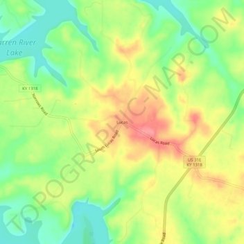
Name: Lucas topographic map, elevation, terrain.
Location: Lucas, Barren County, Kentucky, 42156, United States (36.87172 -86.05748 36.91172 -86.01748)
Average elevation: 197 m
Minimum elevation: 155 m
Maximum elevation: 243 m
Thank you for supporting this site ❤️
Make a donation
Make a donation
Other topographic maps
Click on a map to view its topography, its elevation and its terrain.