
额尔古纳市 topographic map
Interactive map
Click on the map to display elevation.
About this map
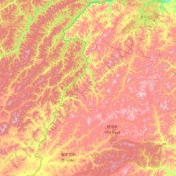
Name: 额尔古纳市 topographic map, elevation, terrain.
Location: 额尔古纳市, Hulun Buir, Innere Mongolei, China (50.01177 119.14251 53.33289 121.80917)
Average elevation: 762 m
Minimum elevation: 308 m
Maximum elevation: 1,476 m
Other topographic maps
Click on a map to view its topography, its elevation and its terrain.
Yakeshi
China > Innere Mongolei > Hulunbuir
Yakeshi, Hulunbuir, Innere Mongolei, China
Average elevation: 737 m
Linkes Alxa-Banner
Linkes Alxa-Banner, Alxa-Bund, Innere Mongolei, China
Average elevation: 1,331 m