
Thank you for supporting this site ❤️
Make a donation
Make a donation
Wenden topographic map
Click on the map to display elevation.
Thank you for supporting this site ❤️
Make a donation
Make a donation
About this map
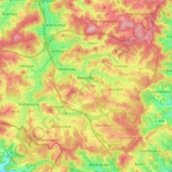
Name: Wenden topographic map, elevation, terrain.
Location: Wenden, Kreis Olpe, Noordrijn-Westfalen, 57482, Duitsland (50.92457 7.77974 51.00342 7.94207)
Average elevation: 399 m
Minimum elevation: 276 m
Maximum elevation: 516 m
Thank you for supporting this site ❤️
Make a donation
Make a donation
Other topographic maps
Click on a map to view its topography, its elevation and its terrain.
Thank you for supporting this site ❤️
Make a donation
Make a donation
Thank you for supporting this site ❤️
Make a donation
Make a donation