
Taday topographic map
Interactive map
Click on the map to display elevation.
About this map
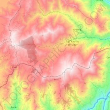
Name: Taday topographic map, elevation, terrain.
Location: Taday, Azogues, Cañar, Ecuador (-2.69079 -78.77674 -2.62520 -78.61672)
Average elevation: 2,961 m
Minimum elevation: 2,016 m
Maximum elevation: 3,748 m
Other topographic maps
Click on a map to view its topography, its elevation and its terrain.
San Miguel de Porotos
San Miguel de Porotos, San Miguel, Azogues, Cañar, 030154, Ecuador
Average elevation: 2,664 m