
Thank you for supporting this site ❤️
Make a donation
Make a donation
Stephenville topographic map
Click on the map to display elevation.
Thank you for supporting this site ❤️
Make a donation
Make a donation
About this map
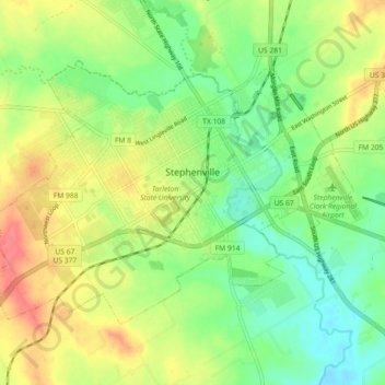
Name: Stephenville topographic map, elevation, terrain.
Location: Stephenville, Erath County, Texas, United States (32.18885 -98.26504 32.25188 -98.17313)
Average elevation: 401 m
Minimum elevation: 369 m
Maximum elevation: 443 m
Thank you for supporting this site ❤️
Make a donation
Make a donation
Other topographic maps
Click on a map to view its topography, its elevation and its terrain.