
Thank you for supporting this site ❤️
Make a donation
Make a donation
Rocky Mount topographic map
Click on the map to display elevation.
Thank you for supporting this site ❤️
Make a donation
Make a donation
About this map
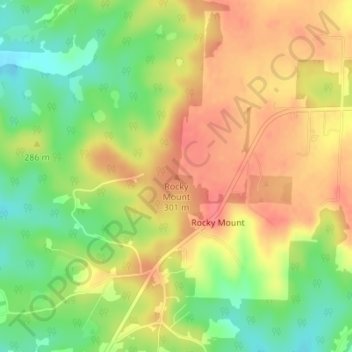
Name: Rocky Mount topographic map, elevation, terrain.
Location: Rocky Mount, Miller County, Missouri, United States (38.32766 -92.66930 38.32776 -92.66920)
Average elevation: 278 m
Minimum elevation: 242 m
Maximum elevation: 307 m
Thank you for supporting this site ❤️
Make a donation
Make a donation
Other topographic maps
Click on a map to view its topography, its elevation and its terrain.