
Eldon topographic map
Click on the map to display elevation.
About this map
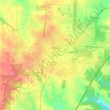
Name: Eldon topographic map, elevation, terrain.
Location: Eldon, Miller County, Missouri, United States (38.32787 -92.60355 38.36568 -92.55129)
Average elevation: 280 m
Minimum elevation: 231 m
Maximum elevation: 314 m
Other topographic maps
Click on a map to view its topography, its elevation and its terrain.